Update 19 March 2024: Defra has disclosed the most recent version of the LandIS agreement.
A good question recently, from environmental campaigner Guy Shrubsole: "When will Cranfield's national soils survey data be made open data?"
Soil is moving up the policy agenda. Last month the Natural Capital Committee published advice on metrics for soil health within the Government's 25 Year Environment Plan. In a speech this week, Environment Agency chair Emma Howard Boyd said that soil degradation in England and Wales is calculated to cost £1.2 billion every year.
So the availability of soil data matters.
'Cranfield' is the Soil and Agrifood Institute at Cranfield University.
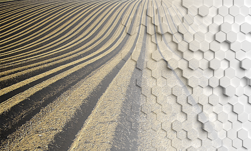
Cranfield maintains LandIS, the most significant digital repository of soil and soil-related information for England and Wales.
In a 2016 letter Andrea Leadsom MP, then Secretary of State for Environment, Food & Rural Affairs, called the Cransfield soils data an important national asset:
We recognise that the soils data owned by Cranfield is an important national asset: the data is more comprehensive than other fragments of soils data Defra group holds, and it is important that we help Cranfield understand how we and others want to use it, and in doing so help them realise the value of making this data more accessible. |
The principal LandIS dataset is the National Soil Map of England and Wales (NATMAP), a 1:250,000 scale vector map that describes soil associations and series at a high level of detail within a spatial framework of interactions with other data products and information sources.
However behind this modern version of NATMAP is a long history of data collection involving decades of soil surveys and hundreds of person-years of fieldwork – most of which was publicly funded.
Intellectual property rights in this soils survey data are complex.
Public funding for LandIS
Defra has been paying for LandIS since at least the early 1990s. A search of Defra's project database indicates the department has so far spent more than £4 million on development, updates and support.
Defra has released a copy of its latest agreement with Cranfield for the maintenance and licensing of LandIS, following my Freedom of Information request.
This agreement seems to provide Defra and other Crown bodies with royalty-free use of soils data from LandIS, subject to constraints. However other public bodies, including non-departmental public bodies in the Defra network, are outside the scope of the agreement.
Defra has redacted the financials from the released copy of the LandIS agreement. However Defra's open spending data shows several payments in 2018 of between £42,000 and £45,000. In December Natural England also paid Cranfield £84,000 for "Access to Landis Digital Soils Datasets".
For other users, Cranfield sets a range of prices for licensing of soils data. Perpetual licences do not seem to be available. The base cost for a single user annual licence for the Digital National Soil Map (NATMAPvector) product is £500 per 1000km2, and a corporate licence for commercial use with full coverage for England and Wales is £75,350 + VAT.
Tell the Geospatial Commission
The LandIS model doesn't work for everybody. Last year several respondents to the Geospatial Commission's call for evidence on geospatial strategy highlighted the poor availability of detailed soils data.
Natural England:
Detailed soil mapping is currently available under license from Cranfield Soil and AgriFood Institute. Whilst this is licensed to Defra the licensing restricts the publishing of derived products which means that it is often not used and the licensing costs restricts wider availability. |
The Joint Nature Conservation Committee (JNCC):
Soils data is currently very costly to access and only available under licence. It would provide a key resource for habitat mapping, habitat condition assessment, natural capital and ecosystem service analyses. |
And an individual from Newcastle University:
The legacy of available, publicly funded, accurate geospatial datasets has been severely damaged by political agendas in recent decades. The decision to disband the Soil Survey of England & Wales is but one example – the dataset is archived, no longer maintained and almost impossible to access. |
Does the LandIS maximise re-use?
These are not new concerns. An evaluation by Atkins in 2003-04 raised doubts about value for money from the LandIS agreement:
Examining the value provided to Defra from their contribution under the LandIS agreement, the superficial conclusion is that for the majority of years there are insufficient licences requested under the agreement to justify the expenditure. |
Soil science is a specialised area, and it would take considerable investigation to understand the sources and ownership of all of the underlying survey data. However Schedule 1 in the LandIS agreement sets out a long list of materials and datasets with notes on their putative owners. In many cases the schedule indicates shared ownership between Defra and Cranfield.
It is likely that understanding of intellectual property rights in some of the material has been complicated by the process of digitising survey data originally recorded on paper, as the party digitising the data can acquire database rights in the digitised versions even if they had no copyright in the source material.
It may also be that in the past some soil survey projects funded by government under contract did not clearly assign IP rights to the Crown – this is one of the pitfalls of outsourcing, and is a common oversight even today in public-private partnerships that produce environmental data.
In some cases material listed in the schedule is owned by Defra outright, and there is suggestion elsewhere in the agreement that Cranfield can make this material available for re-use under the Open Government Licence. However there is no obvious mention of open data on the LandIS website.
In its FOI response, Defra nevertheless confirmed that government does not receive any share of the licensing income from LandIS. Defra does not hold information on Cranfield's own total annual income under the LandIS arrangements.
Renationalise our soils data?
In her letter Leadsom admitted Defra's frustration at delays in sharing of soils data but said they needed to "respect the rights of ownership over the soils data itself."
A future government might cast a more critical eye over the basis of those rights – and consider taking this important national asset (back) into public ownership.
In the meantime it would be worth making a fresh evaluation of the current LandIS arrangements to determine whether they present good value for public money, and whether they ensure that national soils survey data is used to its full potential.