This is a map of school sites in England that overlap with known areas of historic landfill. (Zoom in to see the individual sites.)
A school complex in Coatbridge, North Lanarkshire is in the news at the moment because it was built on a former landfill and industrial site and now blue-tinted water is coming out of the taps. Authorities are seeking to allay health concerns and have ordered an independent review.
This made me wonder how many other schools might be built on landfill. Unfortunately, with the exception of South Ayrshire, government in Scotland has not published its spatial data for closed landfill sites.
However it is possible to compare school sites and historic landfill sites in England, by combining data from the Environment Agency's Historic Landfill Sites dataset with data from the functional sites layer in Ordnance Survey's OS OpenMap – Local.
This exercise identified more than 500 school sites in England that overlap with historic landfill sites. A historic (closed) landfill site is one where there is no waste management licence or permit currently in force.
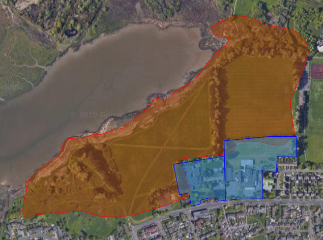
At some sites shown on the map the area of historic landfill is merely on an adjoining parcel of land, and the polygons overlap slightly due to imprecision in the data.
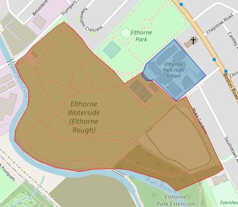
At many other sites, the area of historic landfill only overlaps with playing fields or school grounds rather than the footprint of school buildings.
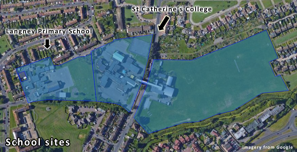
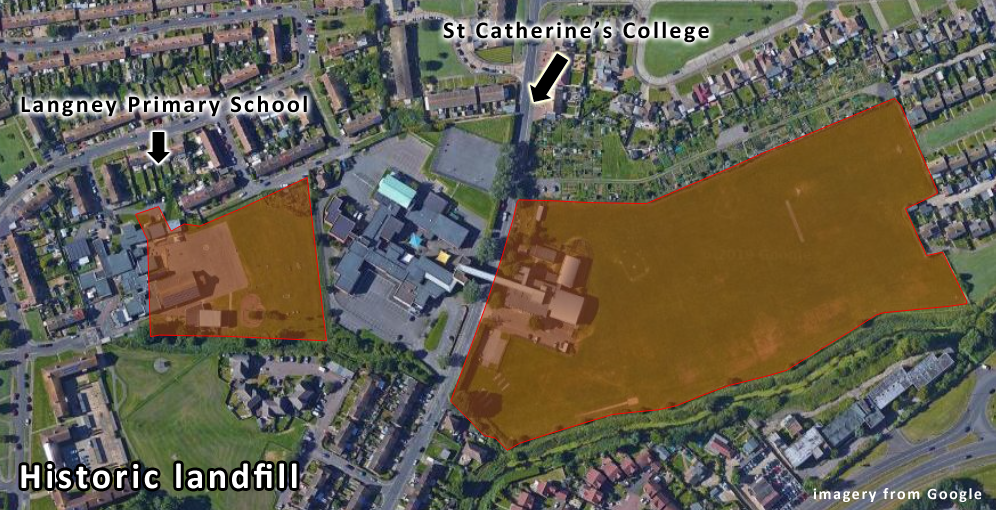
Other sites, such as the Langney County Primary School landfill in Eastbourne, are monitored for landfill gas and other risks by the local authority responsible for environmental health.
The EA dataset does not provide much detail on the types or status of the waste at individual sites. However at nearly half of the sites shown on the map the waste is flagged as "inert", which means it will not undergo any significant physical, chemical or biological transformations. EA's technical guidance is a good source of information on how landfill is classified and regulated.
The version of EA's Historic Landfill Sites that I downloaded to produce this map lacked documentation. However according to metadata the revision date was 09/10/2018. A user guide from 2015 includes an appendix with some information about the attributes in the dataset.
The provenance of the schools data in OS OpenMap – Local is unclear but it may not be entirely up to date as some of the school names do not match the Department for Education's EduBase records.
The Environment Agency's Historic Landfill Sites dataset is freely available but not licensed as open data because EA considers that some of the information about licence holders is personal data. However last year EA gave me permission to re-use a redacted version under the Open Government Licence – I've published the redacted dataset and wrote a blog post about it.
An equivalent Historic Landfill Sites dataset for Wales has been released by Natural Resources Wales under the Open Government Licence.
Information on historic landfill in England is not as readily available as it used to be. In 2013 I raised some questions about the disappearance of key information about landfill sites from the Environment Agency's What's in your backyard? online mapping facility. WIYBY itself was taken offline early last year. Some parts were replaced by mapping applications on the Defra Data Services Platform. However EA no longer publishes a national map of landfill sites.