Post: 3 June 2014
In the past day or two the Environment Agency has released seven additional datasets under the Open Government Licence:
These are available for download from the EA’s DataShare site.
The three WFD datasets were included in a list of upcoming open data releases announced by the EA at the end of April. These datasets complement the release of a package of live river level and flood warning feeds in February. (See my post from last week for more background.)
The EA has now released about 65 datasets under the OGL. Most are probably suitable only for specialist purposes. However cumulatively the EA is building up a pretty good portfolio of open data products.
WFD - River Waterbodies
From the above list, WFD - River Waterbodies is the dataset in which I am personally most interested. I have been campaigning for some time for the Government to release a dataset of river network centrelines. The data exists as a subset of the Detailed River Network, which is being deprecated in favour of the new Water Layer in OS MasterMap; however both of those are commercial products.
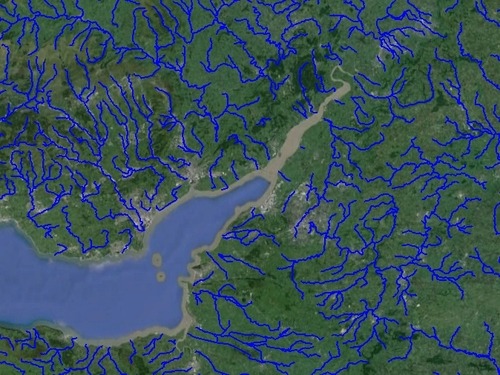
The River Waterbodies dataset is the closest we currently have to an open and attributed spatial dataset of rivers in England and Wales:
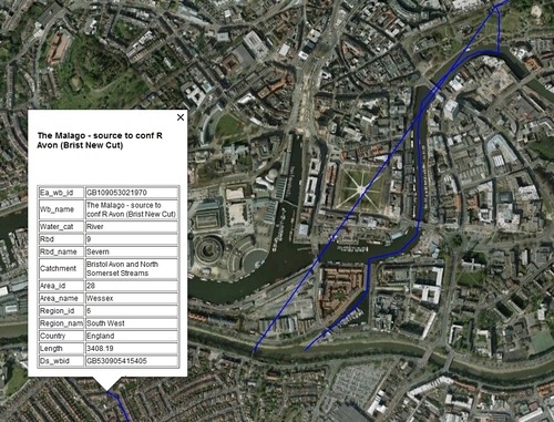
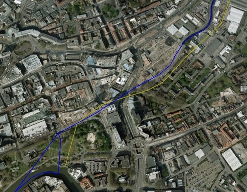
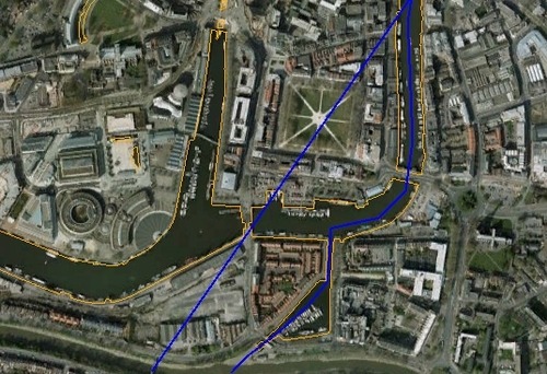
Close-up for an area of Bristol:
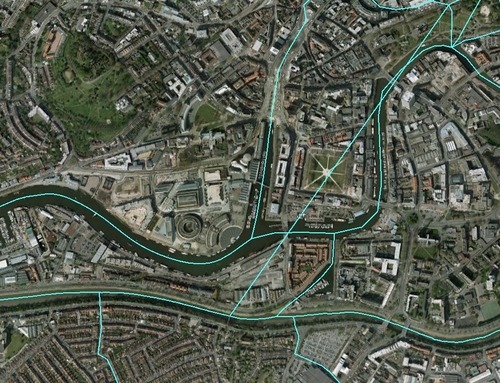
The River Waterbodies dataset is based on the Detailed River Network but is more limited in both detail and coverage. Below are the DRN polylines for the same area of Bristol:
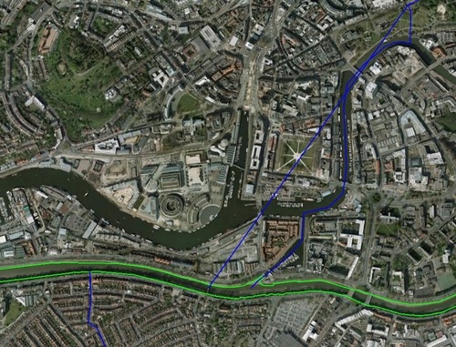
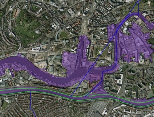
For general use the main issue with this version of the River Waterbodies dataset is the lack of coverage for estuaries, some of which flow quite far inland. However we can make up for this to some extent by adding the high water polyline from Ordnance Survey’s Boundary-Line product, which is also open data:
The River Waterbodies dataset is more accurate than other open data alternatives such as the river polyline in OS Meridian 2:
Here’s the River Waterbodies dataset overlaid on surface water lines from OS VectorMap District:
and here’s the River Waterbodies dataset overlaid on flood warning area polygons:
Of course this version of the River Waterbodies dataset is the Cycle 2 draft, which I think means there will be further refinements before the final version is released.
Images attribution: all polygon and polyline data © Environment Agency copyright and database rights and/or © Natural Resources Wales (NRW) copyright and database rights; background imagery Google Earth.