Post: 16 February 2014 (Before #floodhack; see addendum below. I’ve also written a more general post on unlocking EA flood data.)
There’s a “hackathon” called #floodhack going on in London today, organised at Campus London with the cooperation of the Cabinet Office and the Environment Agency. Details are on this Hackpad:
I’m not a developer but I have a specialised interest in flood risk data, so I’ve been following the preparations for #floodhack. In particular I’ve been looking at the datasets the EA have made available and the licensing terms that apply to them.
Of course I’m mainly keeping an eye out for any sign of new open data …
Datasets and Licensing
The EA have put their key data for #floodhack on the Gov.uk website:
with a link to a feed of river-level data that updates every 15 minutes.
There is also a wide range of other potentially useful data for download from the EA’s ShareFile repository (behind a registration/login process):
https://ea.sharefile.com/i/i92b74cfe07f48a5a
The repository includes some datasets from English Heritage, the Canal & Rivers Trust, Natural England and the UK Hydrographic Office in addition to the EA’s own data. (It looks as if this collection of datasets may have been put together for an earlier hackathon.)
Below are links to copies of the licensing documentation from the ShareFile repository:
Hackathon Datasets List
Licensing EA Data and the Hackathon Q+A
Special Licence - Non-commercial (NCSL)
Special Licence - Co-Deliverer (CDSL)
Open Government Licence (OGL)
All of the datasets are listed as either OGL, PSMA or EA LICENCE.
The Q&A explains the EA’s position on open data (and why they feel entitled to commercially exploit most of their data assets instead). There is a full list of the EA’s existing OGL datasets on DataShare; in my judgement almost all are niche products with little potential for reuse.
There is information about Public Sector Mapping Agreement (PSMA) licensing on the Ordnance Survey website. For purposes of use at hackathons I take “EA LICENCE” to mean that the non-commercial licence applies. (Note the EA’s NC licence is substantially more restrictive than the model Non-Commercial Government Licence.)
Open River-Level Data Feed
Have the Environment Agency released any new open data for the #floodhack event? Yes: the river-level data produced every 15 minutes from the EA’s API has been released under the OGL until May 2014.
Technically this means the public is free to download the river-level data files and keep them indefinitely (i.e. over-riding the EA’s normal prohibition on long-term archiving of the data). However in practice there’s probably not much reuse potential in three months worth of river-level data, beyond the specific aims of the hackathon.
The flood warning and flood alert area polygons, available from the Gov.uk page for use with the Shoothill API, have not been released under the OGL according to the datasets list. Licensing for the information in the two csv files (“River and sea levels map” and “Rainfall gauges without locations”) is unclear. Those files seem to contain contextual information for use with the river-level feeds.
[ Update to the above paragraph: see Addendum below. ]
Opening Up? Not Really
In summary this very limited release of open data does not represent a significant “opening up” of government resources. The arrangements for river-level data are slightly more flexible than release of the data under a three-month developer licence would have been, but the effect is broadly similar and presents no erosion of the Environment Agency’s strongly commercial stance on licensing of flood data.
There has been a good effort to pull together existing open datasets that might be useful to #floodhack developers. However most of the EA’s flood-related datasets remain subject to restrictive licensing.
That said, it is possible that the #floodhack event will (in addition to its laudable aims) generate new interest in the Environment Agency’s flood data assets and promote support for releasing those assets as open data.
Although #floodhack is focused on the current weather crisis, river levels and other event-specific flood datasets are only a part of the picture. The management of flood risk is an ongoing problem that cuts across society and the economy. There is even more potential in unlocked the EA’s core flood datasets and expanding beyond their current limited reuse in the property sector and financial services.
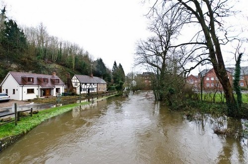
Photo credit: Flooding from Eashing Bridge by Darren Johnson, CC BY 2.0
Addendum (after #floodhack):
Based on Twitter discussions there is some confusion about the licensing status of the Flood Alert Areas and Flood Warning Areas polygons mentioned above. #Floodhack participants were apparently told verbally that the polygons were covered by the Open Government Licence (OGL), but at the time of writing this is not reflected on the download page. I am waiting for clarification from the Environment Agency and will update this post accordingly.
Update (17 February 2014):
The two polygon datasets have now been catalogued on Data.gov.uk (Flood Warning Areas and Flood Alert Areas), labelled as OGL. This removes the ambiguity on the Gov.uk download page: the datasets have been released as open data. Thanks to the EA for clarifying the licensing position.