Post: 26 November 2017
This is from Wednesday’s Autumn Budget:
4.14 Geospatial data – The UK has some of the best geospatial data in the world, and much of it is held by public bodies. The potential economic value of this data is huge. To maximise the growth of the digital economy and consolidate the UK’s position as the best place to start and grow a digital business, the government will establish a new Geospatial Commission to provide strategic oversight to the various public bodies who hold this data. To further boost the digital economy, the government will work with the Ordnance Survey (OS) and the new Commission, by May 2018, to establish how to open up freely the OS MasterMap data to UK-based small businesses in particular, under an Open Government Licence or through an alternative mechanism, while maintaining the OS’s strategic strengths. The Budget provides £40 million a year over the next two years to support this work.
Followed by a press release with slightly more detail: Chancellor to unlock hidden value of government data.
Several open data people have already posted reactions: read Ed Parkes and Leigh Dodds to get an idea of the range.
Clearly we need to put some caveats around this. The announcement provides only limited information about the Government’s plans for the new Geospatial Commission. And this was a relatively minor item in a wide-ranging budget, so we don’t know how carefully it was written.
However I’m cautiously optimistic that this announcement has potential as a significant advance for open data and open spatial infrastructure in Britain.
Below is my interpretation of the announcement.
(Disclosure: I work on open data in the public sector, but I don’t have any relevant inside knowledge. This post is personal comment.)
The direction of travel is in our favour
Compare this commitment from the Conservative Party’s election manifesto in May:
Digital Land
And we will use digital technology to release massive value from our land that currently is simply not realised, introducing greater specialisation in the property development industry and far greater transparency for buyers. To make this happen, we will combine the relevant parts of HM Land Registry, Ordnance Survey, the Valuation Office Agency, the Hydrographic Office and Geological Survey to create a comprehensive geospatial data body within government, the largest repository of open land data in the world. This new body will set the standards to digitise the planning process and help create the most comprehensive digital map of Britain to date. In doing so, it will support a vibrant and innovative digital economy, ranging from innovative tools to help people and developers build to virtual mapping of Britain for use in video games and virtual reality.
Wednesday’s announcement is an iteration of the manifesto commitment, but we can see there has been further thought and discussion. The idea of creating a new body from parts of the existing bodies responsible for land data was rather unrealistic; casting the Geospatial Commission as an oversight body is more plausible.
Coal Authority has been added to the group of bodies the new Commission will “draw together”. Which is interesting.
Treasury is speaking the language of open
More so than in the manifesto commitment, Wednesday’s announcement includes phrases that resonate with the open data community: “open up freely”, specific mention of the Open Government Licence, and “unlocking” in the press release.
The focus on OS MasterMap, the keystone for any serious effort to build open spatial infrastructure in Britain, is also encouraging.
There’s still plenty of hedging in the announcement, such as the bit about an “alternative mechanism”. But there is evidence of a plan here. £80 million over two years is too much for admin and governance; that money has been earmarked for something, however tentatively.
Look at who’s involved
We have a press release from the Treasury and Cabinet Office, with quotes from CO minister Damian Green, Open Data Institute chairman Nigel Shadbolt, and Saul Klein of venture capital firm LocalGlobe.
The ODI has recently been given a new lease on life with £6 million in new public funding. LocalGlobe has a track record of funding startups that innovate with open data, such as Citymapper and Zoopla.
No mention in the announcement of the Department for Business, Energy & Industrial Strategy, which is curious given that BEIS owns or controls Ordnance Survey and most of the other bodies the Geospatial Commission will oversee. (UKHO is a trading arm of MOD; only VOA is accountable to Treasury.)
What should we make of the fact that Ordnance Survey had nothing to say about the Geospatial Commission until two day after the Chancellor’s speech?
In other news: GeoPlace is looking for a new managing director.
Some of this will be coincidence or unrelated. But …
Is Treasury finally warming up to the economic potential of open data?
Or is this just a thing for small business?
The main cause for doubt in Wednesday’s announcement is the reference to opening up MasterMap “to UK-based small businesses in particular”. The risk is that BEIS or a commercially-minded faction within OS could talk Treasury out of a proper open data release in favour of a more limited approach that attempts to ringfence benefits for small businesses.
We’ve seen this tactic before: OS’s introduction of the Public Sector Mapping Agreement (PSMA) was successful in placating demand for open data within the public sector, and Royal Mail offered free access for micro businesses and small independent charities to divert outrage over the privatisation of the Postcode Address File (PAF).
But I don’t read it that way.
Spatial infrastructure in the UK is overdue for better governance. If Government wants to make progress on housebuilding and reform of the planning system, we need a more joined up system for managing land data. The barriers that Royal Mail and Ordnance Survey derived data present to open release of Land Registry records are a stark illustration of the problem.
But if Government talks about opening land data, the public may assume the benefits will flow mainly to developers and property investors. Emphasising the benefits for small businesses makes good political sense.
“In particular” need not mean “only”. There is a strong argument that a full open data release of MasterMap will benefit small businesses “in particular” even without preferential treatment. Licensing costs are incidental for big businesses but a barrier to entry for small businesses – so open data rebalances the playing field in their favour.
The press release indicates an ambition to unlock “up to £11 billion of extra value for the economy every year”. It’s not clear where that figure has come from, but just giving small businesses free access to MasterMap won’t deliver economic benefits on anywhere near that scale.
Free access to MasterMap would reduce input costs for small businesses. However without more fundamental changes to the scope for re-use of the data, and without rights to redistribute the data freely to customers and end users, they would be competing in the same limited space as larger firms who have been working with the data for years.
If MasterMap was released as open data, on the other hand, that would create potential for many new use cases; online and public-facing in particular. In that unexplored space small businesses would have greater opportunity to innovate, by finding niche applications or using their greater agility to compete.
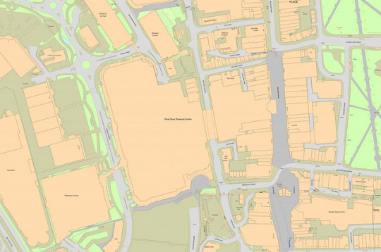
Image: The West Quay area of Southampton in 2014 shown in OS MasterMap (Ordnance Survey, CC BY-NC 2.0)