Post: 10 February 2015
Environment Agency released some new open data this week: a spatial dataset called Water Resource Availability and Abstraction Reliability.
The dataset indicates whether, and for what percentage of time, additional water may be available for consumptive abstraction from river, lake and transitional water bodies in England.
“Consumptive abstraction” refers to abstraction of water without returning it to the natural environment. Environment Agency operates a permitting system to control the abstraction of water.
The dataset tells us two things about each water body: whether water resources are available for abstraction licensing, and the percentage reliability of consumptive abstractions.
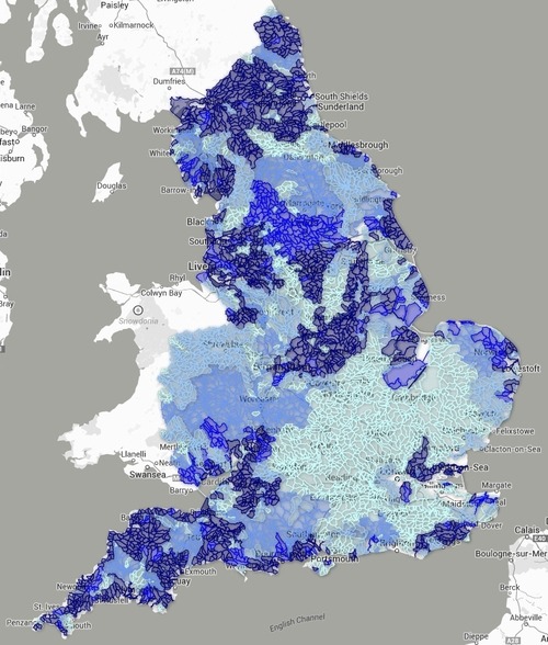
I have made an interactive map to visualise the percentage reliability:
(The map has some performance issues due to the size of the dataset. For more serious use it would be sensible to generalise the catchment polygons.)
See the documentation for more information about the Water Resource Availability dataset.
Other data on water abstractions
Defra publishes annual water abstraction estimates for England and Wales.
There are also a couple of related Environment Agency datasets that are not currently available as open data.
One is the Water Abstraction Licences themselves. An unlocking request was submitted for that dataset last year. In the meantime the licences are visualised on EA’s own interactive map.
There also seems to be a spatial dataset called Consumptive Groundwater Water Abstractions, which shows long term averages of water abstracted from the ground.
Image: map derived from the dataset described above. Data is © Environment Agency copyright and/or database right 2014. All rights reserved.