Post: 15 February 2014
At the moment very few of the Environment Agency’s flood-related datasets are available as open data. However here is one spatial dataset that has been approved for release as “EA Open Data”:
Flood and Coastal Erosion Risk Management Frequent Maintenance Programme for England (AfA266)
I received this data last month following an information request to the EA. The dataset is not available for download from the EA’s DataShare page and is probably suitable only for specialised purposes. However as there has been a spike in interest in flood data this week I’m putting a copy up here in case it’s of use to anyone besides me.
The data is in shapefile format and covers both the 2012/13 and 2013/14 maintenance programmes. I have included metadata and additionally there is contextual information on the EA website.
Please see the enclosed notice for the terms applicable to reuse of this EA Open Data. (I am trying to encourage the EA to standardise release of EA Open Data under either the Open Government Licence or the OS OpenData Licence, as the terms in the EA notice are a little more restrictive.)
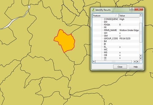
Below to pique your interest is a simple thematic map based on the 2013/14 version of the dataset, with the investment areas colour-coded according to the degree of severity of the consequence of lack of maintenance. (Note this doesn’t suggest any actual lack of maintenance.) Red = high, amber = medium, green = low.
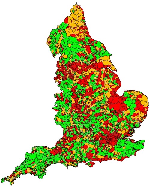
Images produced from the dataset described above. Attribution: “Contains Environment Agency information © Environment Agency and database right”.