Post: 16 May 2013
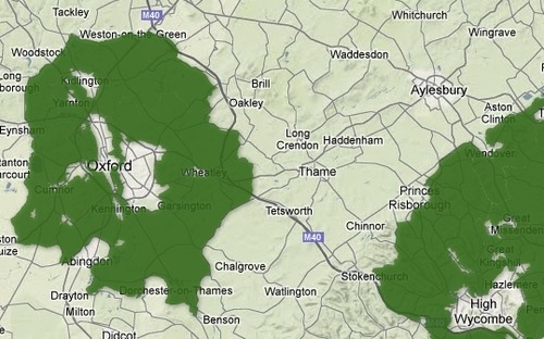
Some of us with an interest in open data were quite excited when, in late November of last year, the Telegraph not only published the first detailed web-based map of the Green Belt in England, but also made the full underlying dataset (a shapefile obtained from the Department for Communities and Local Government) available for download.
According to the Telegraph article:
This map is the first time it has been possible for members of the public to easily see which areas are green belt land, and which are not.
The Department for Communities and Local Government released the data for the 2011 green belt to the Telegraph, and it is being made available here to view, explore, share and download.
Previously the data has only been available at a cost of tens of thousands of pounds from a third party, despite the location of green belt land being identified by councils using taxpayer money.
Expert users may also download a copy of the green belt map (29MB ZIP file) for use in geographic information systems (GIS).
Green Belt boundaries are a classic example of national core reference data that should be available for public re-use under an open data licence. I first wrote about this dataset back in January 2012, and Alasdair Rae made a strong case for open data release in an article on the Guardian website in August 2012.
The apparent release of the Green Belt dataset by DCLG therefore looked like progress (even if using the Telegraph to distribute it seemed a bit unusual). No less than Ed Parsons, Google’s chief geospatial technologist, applauded the data release in a blog post. Was DCLG “the new opengov data poster child”?
Alas, no. It was all a cock-up …
I have now obtained, under the Freedom of Information Act, the relevant e-mail correspondence between DCLG, the Telegraph and Ordnance Survey. The Green Belt shapefile has not been released as open data, or even to share, by DCLG. Indeed DCLG claim never to have given the Telegraph permission to make the data available for distribution at all.
You can download my FOI request and DCLG’s full response, including the e-mails. However following are the key points:
DCLG’s conclusion is that “the shapefile published by the Telegraph is in effect unlicensed as it was published without our permission. Notwithstanding that, any Green Belt boundaries provided by local authorities (as in the published shapefile) may only be used for non-commercial uses.”
So what does all this mean?
The first and most obvious point is that DCLG have confirmed the Green Belt shapefile is not currently open data. That’s unfortunate, but Ordnance Survey’s position is encouraging and we can continue to press DCLG to resolve any remaining issues with local authorities.
The complication is that the Green Belt data is now already in circulation, unaccompanied by any clear licensing information. The shapefile remains available for download on the Telegraph website at the time of writing, and is also now available from the London Datastore and ShareGeo Open repositories. It has also been added as a layer to RPTI’s Map for England.
Without any licensing information (other than some obscure metadata), and given that DCLG did not authorise distribution of the shapefile, there is an argument that technically nobody downloading the data has any proper basis on which to re-use it – even for non-commercial purposes. DCLG may have told me that non-commercial use is okay, but they have no mechanism to communicate that more widely to downloaders.
On the other hand, downloaders may already be re-using the Green Belt shapefile in good faith, including for commercial purposes. Since DCLG have made little or no attempt to discourage distribution of the shapefile, they may find it difficult to challenge that re-use.
_____________________________________
Update (20 May 2013):
DCLG have written to clarify that they are “looking to publish Green Belt boundary information ourselves in future and so will consult with local authorities and Ordnance Survey to agree the relevant permissions”.
Update (10 October 2014):
DCLG has now released an open data Green Belt spatial dataset.