This is from the Autumn Budget in November:
4.14 Geospatial data – The UK has some of the best geospatial data in the world, and much of it is held by public bodies. The potential economic value of this data is huge. To maximise the growth of the digital economy and consolidate the UK's position as the best place to start and grow a digital business, the government will establish a new Geospatial Commission to provide strategic oversight to the various public bodies who hold this data. To further boost the digital economy, the government will work with the Ordnance Survey (OS) and the new Commission, by May 2018, to establish how to open up freely the OS MasterMap data to UK-based small businesses in particular, under an Open Government Licence or through an alternative mechanism, while maintaining the OS's strategic strengths. The Budget provides £40 million a year over the next two years to support this work.
These words were carefully chosen, so it's not entirely clear what Cabinet Office intended to happen by May. The accompanying press release adds little beyond a promise that the new Commission will unlock "up to £11 billion of extra value for the economy every year".
But in any case: May has passed and we've had no further public announcement on MasterMap or the status of the Geospatial Commission. So what's going on?
What is MasterMap?
MasterMap is free to use for public authorities under a central funding agreement, but commercial terms apply for use by businesses, charities and the general public. A corporate licence for full coverage of the Topography Layer alone is £4,581,000 per year, so it's easy to see why open data campaigners think MasterMap has untapped potential for re-use in the wider national interest.
In principle releasing MasterMap as open data should be a straightforward, if bold, economic decision. The challenge is mostly in the implementation.
Back in 2010 a previous Government recognised the need for a base layer of freely re-usable national geospatial infrastructure, and we got OS OpenData – an adaptable toolkit of mapping products that radically expanded the accessibility of geographic information in Britain.
Today, with increasingly detailed sources of geographic data coming online from BIM, citizen science, urban sensor networks, and earth observation, that demand has shifted to a more granular level. We need open MasterMap, and the Topography Layer in particular, to function as the new collaborative base layer for location intelligence in Britain.
By now Cabinet Office must have realised there's no way to effectively ring-fence the benefits for small businesses. SMEs operate within supply chains, and exploiting MasterMap across the full range of potential applications on the web requires frictionless sharing of data. But opening MasterMap will still benefit small businesses "in particular", because the costs associated with the current licensing model are a barrier to entry that discourages small businesses much more than large corporates.
Releasing MasterMap as open data will have a significant secondary benefit: the potential to unlock thousands of additional spatial datasets, held by local authorities and other public bodies, that cannot be published as open data now because they are derived from closed MasterMap data.
Why the delay?
Based on job notices, presentations at business events, and so on, we know that Cabinet Office has been staffing a Unit to support the new Geospatial Commission. However a campaign to recruit two Co-Chairs to lead the Commission seems to have gone off track. Those appointments were originally to be announced at the end of March – however one of the roles has recently been re-advertised with final interviews scheduled for July.The latest notice does provide some insight into the scope of the Commission:
- Set the UK's geospatial strategy, and prioritise a portfolio of initiatives with the potential to maximise value for the public and private sectors and drive economic growth through the use of geospatial data
- Hold bodies to account for delivering this strategy
- Set cross-cutting policies and data standards, simplifying and unifying data licensing and standardising data identifiers, schemas and metadata across the public sector
- Engage the private and public sectors to drive key policy outcomes
- Commission cross-government services or platforms to drive key policy outcomes, including considering and recommending the opening of datasets
- Work to maintain an environment wherein geospatial data is high quality, available, and interoperable
The notice also says the Co-Chairs will lead a group of around eight Commissioners, including the Director of the supporting Unit and two representatives from the Commission's Partner Bodies. This is an interesting decision as the Commission has at least six Partner Bodies, including Ordnance Survey, and developing a cohesive UK Geospatial Strategy will depend very much on aligning their institutional priorities.
It's also plausible that progress on the Geospatial Commission has been delayed by recent "Machinery of Government" changes, under which many of Cabinet Office's other data policy functions (including responsibility for open data) have been moved to DCMS – and unspecified "strategic geospatial data policy initiatives" from BEIS and Defra are being consolidated into Cabinet Office to support the work of the Commission.
A suggestion while we wait …
Understandably Cabinet Office may want to get the Co-Chairs and commissioners in place before formally committing to an approach on MasterMap. That could mean waiting another couple of months.
In the meantime, why not run a full public consultation on the UK Geospatial Strategy?
Workshops and industry breakfasts have only a limited reach. Geospatial infrastructure is central to development of our digital economy and a matter of some public interest. The commissioners deserve the widest possible range of insight from across the private, public, and third sectors.
Declaration of interest: I work on open data for a government organisation within the Defra Network. This post is a personal view based on publicly available information.
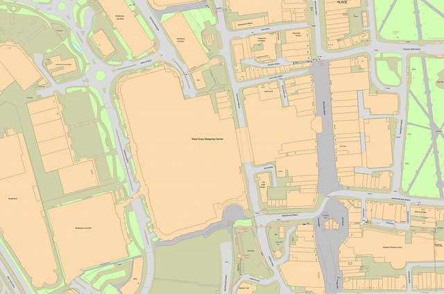
Image attribution: The West Quay area of Southampton in 2014 shown in OS MasterMap (Ordnance Survey, CC BY-NC 2.0)